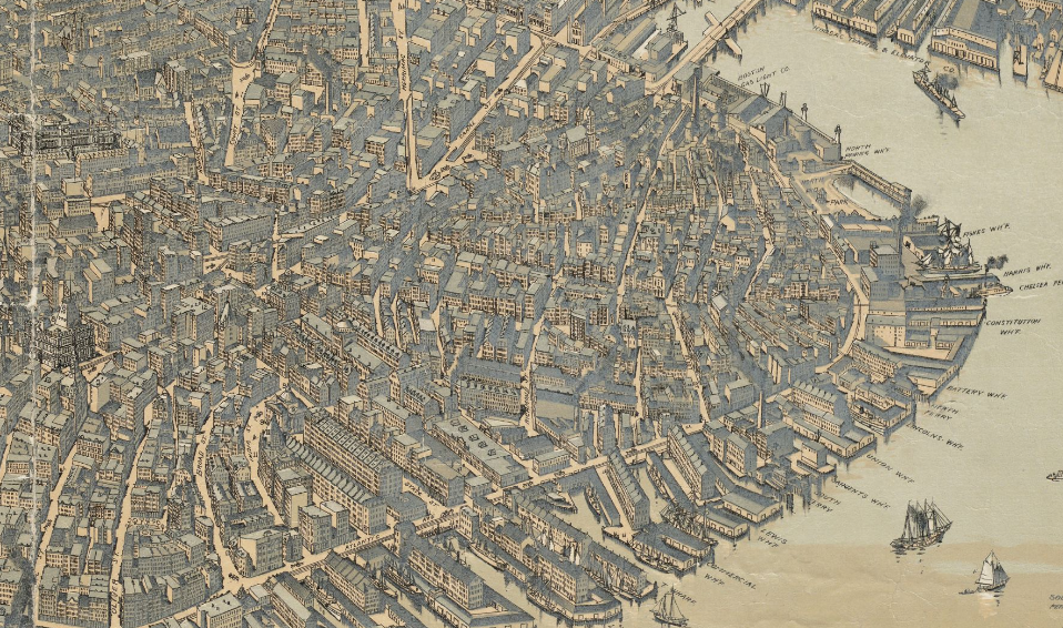
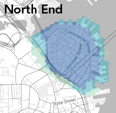
Join the Leventhal Map & Education Center and the North End Branch of the Boston Public Library for a virtual exploration of history through maps on Tuesday, December 1st from 7 p.m. – 8:15 p.m. In the nineteenth century, where was the North End Branch Library? What was at the location where the library now Read More…
Tag: Maps
Neighborhood Maps for Homeownership, Income and Rent Burden
A recent Northeastern graduate, DJ Hartman, recently put together some city-wide maps, highlighting various economic metrics by neighborhood. Let’s take a look at the North End / Waterfront and downtown Boston area. The homeownership rate in the City of Boston is 34.1% (2009-2013). The North End is more transient and rental driven with a homeownership rate of Read More…
Neighborhood Image: 1899 Aerial of the North End
It’s easy to think that the density of the city is a reflection of modern times. That was not the case in Boston and especially the North End where the population was more than triple what it is today. This 1899 aerial image by A.E. Downs from the Boston Public Library Collection gives a sense Read More…
Neighborhoods in Words on New Boston Map
“Narrow Streets, Molto Bene!” “Took Forever to Finish” If you had to guess where those words would appear on a Boston map, you might think of the North End and Big Dig/Greenway. That’s exactly what the folks at Urbane did in a new map of Boston. Some sterotypes just don’t die like “Inner Toxic Harbor” Read More…
Crowdsourcing the North End and Downtown Boston Neighborhood Boundaries
The folks at Bostonography are using the concept of crowdsourcing to define neighborhood boundaries. For the North End, there is not much dispute until you get to the areas south of Christopher Columbus Park and west toward the Bulfinch Triangle. In the map below, the darker area represents greater consensus about what is the “North Read More…
North End is the Heart of Boozeton Per Bostonography Liquor License Maps
If liquor is the lifeblood, then the North End would be the heart of Boston as graphically shown by the map-making geniuses at Bostonography.com. Using liquor license data compiled by the Boston Business Journal, Bostonography’s Tim Wallace created a density heat map of Boston and surrounding areas, entitled Boozeton, Massachusetts. The Boston liquor license density Read More…
Gone Missing: Freedom Trail Map on Cross Street
The large Freedom Trail map mounted on the brick wall at Cross Street Plaza has gone missing. The map was located between Nick’s Famous Deli and the Citizen’s Bank ATM, along the Freedom Trail between Salem & Hanover Streets. No word on whether the map was stolen or removed for repair. Although only about one Read More…