It’s easy to think that the density of the city is a reflection of modern times. That was not the case in Boston and especially the North End where the population was more than triple what it is today. This 1899 aerial image by A.E. Downs from the Boston Public Library Collection gives a sense of how tightly packed in the buildings were in the North End / Waterfront area.
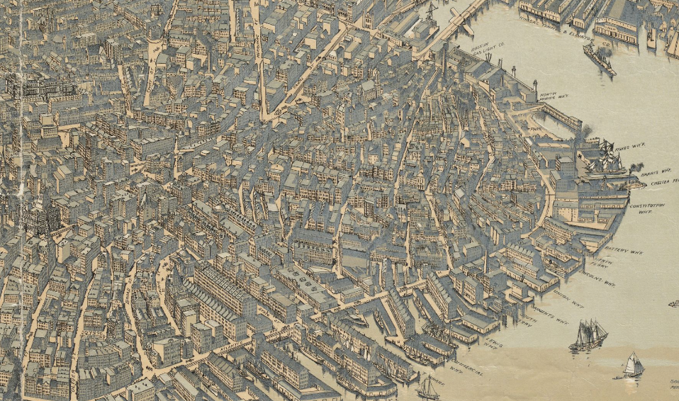
Thanks to Dan Flaherty for sharing the image.
“Neighborhood Photo” is a regular feature on NorthEndWaterfront.com. Did you take an interesting photo in or around Boston’s North End / Waterfront? Have it featured by emailing it to info@northendwaterfront.com. Please include a title, date taken and a sentence or two describing the photo.


