Last Thursday, Boston Harbor Now hosted an open house for community members to learn about updates on the harbor ferry expansion project and share their opinions. The open house included information gathered from stakeholder workshops held this past July and an organized display of sites being considered for further analysis.
Recap from Stakeholders Workshops
Summer workshops were held in Salem, Quincy and Boston, to represent the North Shore, South Shore and inner harbor. Community members discussed sites for new docks and ferries, as well as expansion of current routes. Some common themes that emerged from these sessions are:
- A need for an inner harbor circulator.
- Increased access to the harbor islands.
- Increased number of tourist / recreational sites that can be reached without a car.
Specific themes from the inner harbor workshop included:
- Ferries should operate under one fare payment method.
- Ferry schedules should be coordinated with other public transit schedules. They should operate in the gaps of train schedules to allow for more travel options and should be synced with other transit for easy connections.
- Docks will need to be easily accessible and have increased space to accommodate passengers.
Sixteen potential services were proposed for the inner harbor area. Of these, eight inner harbor sites have been selected for further analysis. Here are all the sites being considered in the next round of analysis, which will happen this winter: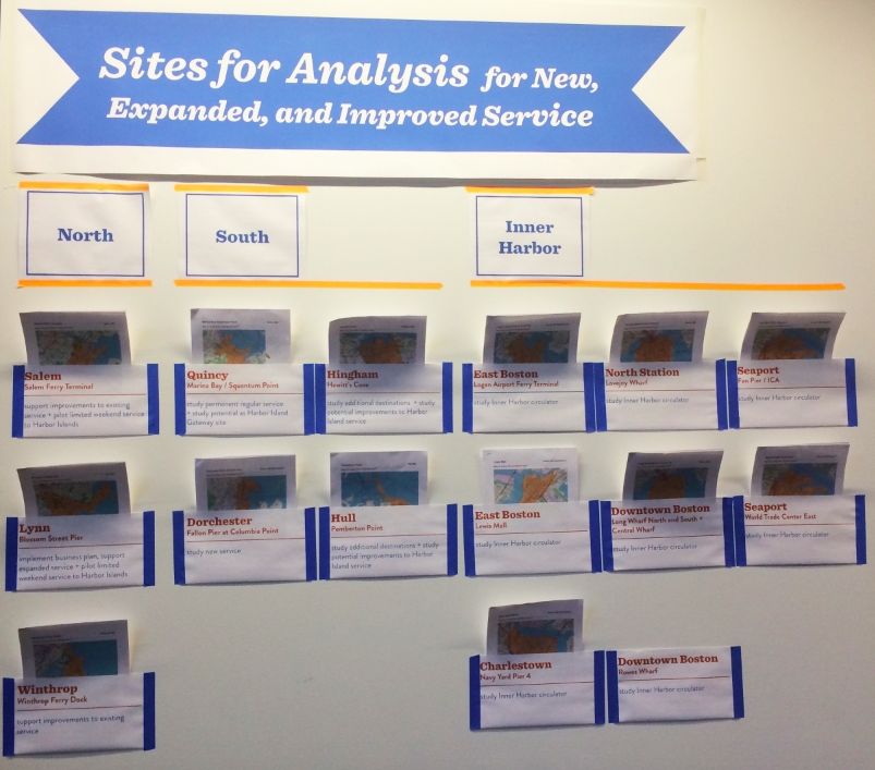
The inner harbor ferry proposal sites are:
- East Boston – Logan Airport Ferry Terminal
- East Boston – Lewis Mall
- Charlestown at Navy Yard Pier 4
- North Station at Lovejoy Wharf
- Downtown Boston – Rowes Wharf
- Downtown Boston – Long Wharf North and South & Central Wharf
- Seaport – Fan Pier / ICA
- Seaport – World Trade Center East
The map below shows current ferry routes. Open circle indicates an existing dock without ferry service, open triangle indicates a proposed dock, filled small circle indicates Harbor Island service, and filled large circle indicates existing dock with ferry service. For those with existing service, proposals include expanded routes and increased frequency.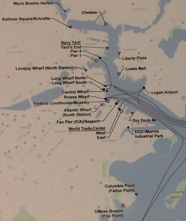
Of the eight inner harbor sites marked for further analysis, approximately 2-4 will be selected for ferry routes. Selection will be based on financial viability, as well as potential demand and landside accessibility to other transit networks. Over the winter, dock sites and potential routes will be analyzed, and the business plan for selected sites will be done in the Spring, with hopes of starting new and expanded ferry routes in 2019.
Additional sites that are not being analyzed this round, but may be considered for medium and long term potential are shown here: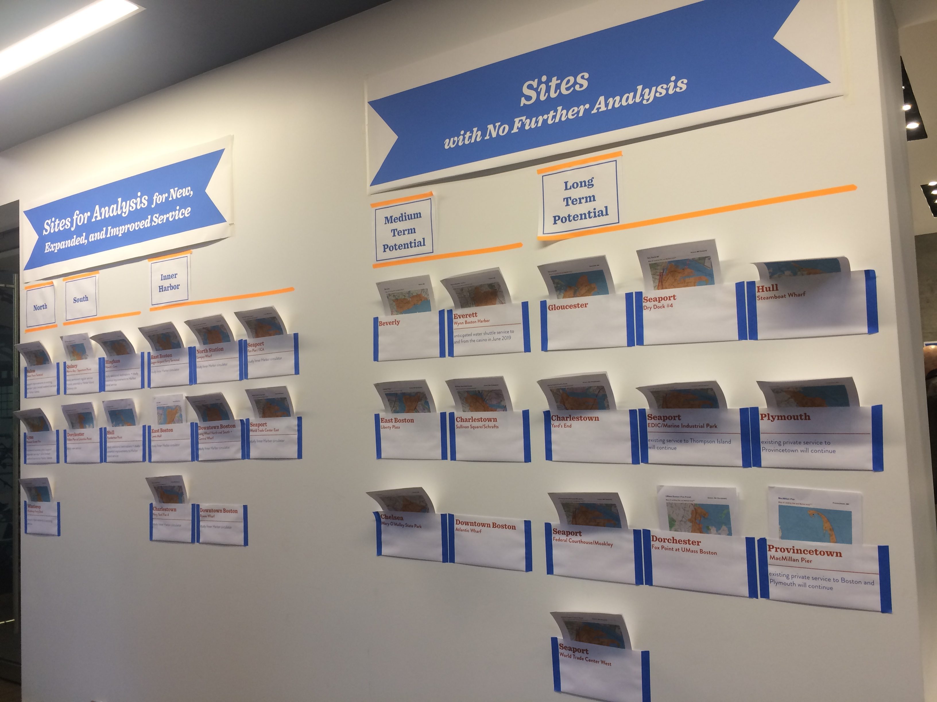
Visit the Boston Harbor Now Water Transportation Study website to learn more. To get involved in this process, contact Alice Brown at abrown@bostonharbornow.org.


