The North Station Area Mobility Action Plan is a multimodal transportation plan that encompasses the surrounding area of North Station and the Bulfinch Triangle. The plan hopes to alleviate traffic and pedestrian congestion while preparing for the residential increase stemming from several developments in that direct area.
You may remember the post about the previous meeting held on January 18th, where we covered the high level topics of the presentation, let’s dive deeper into the plan.
What specific area is included in this plan?
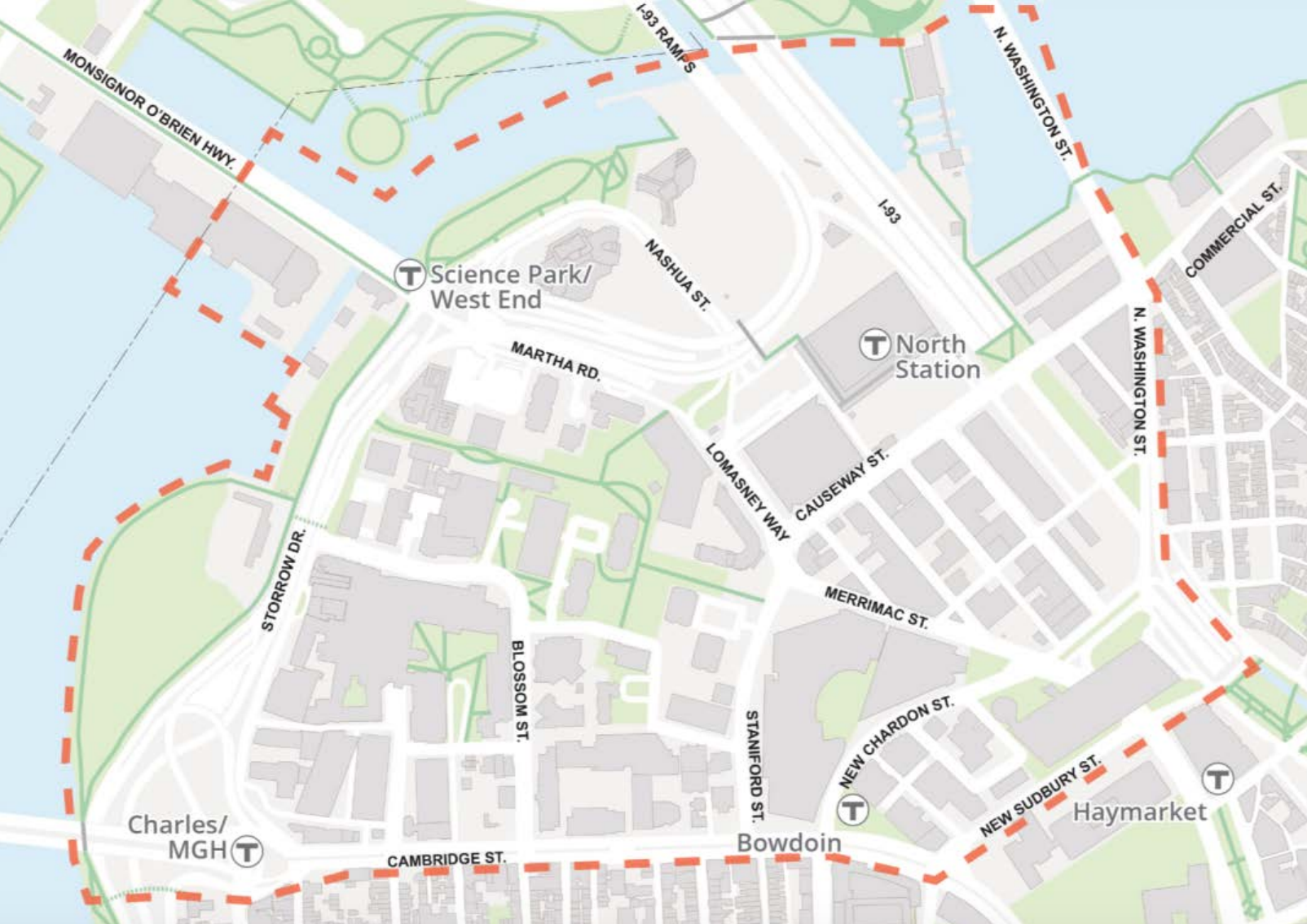
From Massachusetts General Hospital (MGH), to the Government Center Garage, all the way back to the Bulfinch Triangle and the Charles River Park, the plan touches the North End along North Washington Street and a small part of Cross Street.
How much development is currently going on in that area?

There are currently 14 projects that are either in the design phase, or under construction, encompassing a total of 7.7 million square feet.
How exactly is the plan supposed to help?
Taking a multifaceted approach that focuses on the pedestrian environment, offering different options for commuters will be the key to shifting transportation behaviors in the area. Putting less of an emphasis on vehicles, interactive transit screens and signage will be geared towards transit, bikesharing (Hubway), ridesharing services like Uber, and carsharing services such as Zipcar.
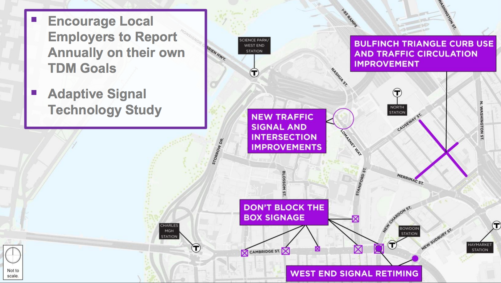
An Adaptive Signal Technology Study will look to help shorten the peak period impacts of traffic by better managing signal timings before and after the heaviest traffic times.
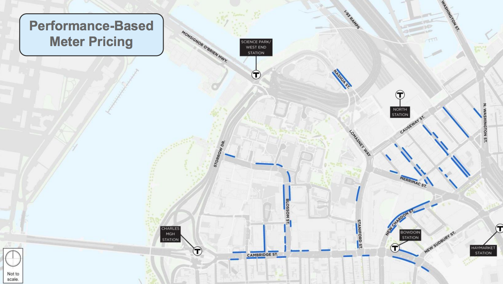
There have been several curbed spaces identified for performance based meter pricing, which aims to create more turnover, instead of a single occupancy. Below, these zones have been identified as potential places for performance-based meter pricing:
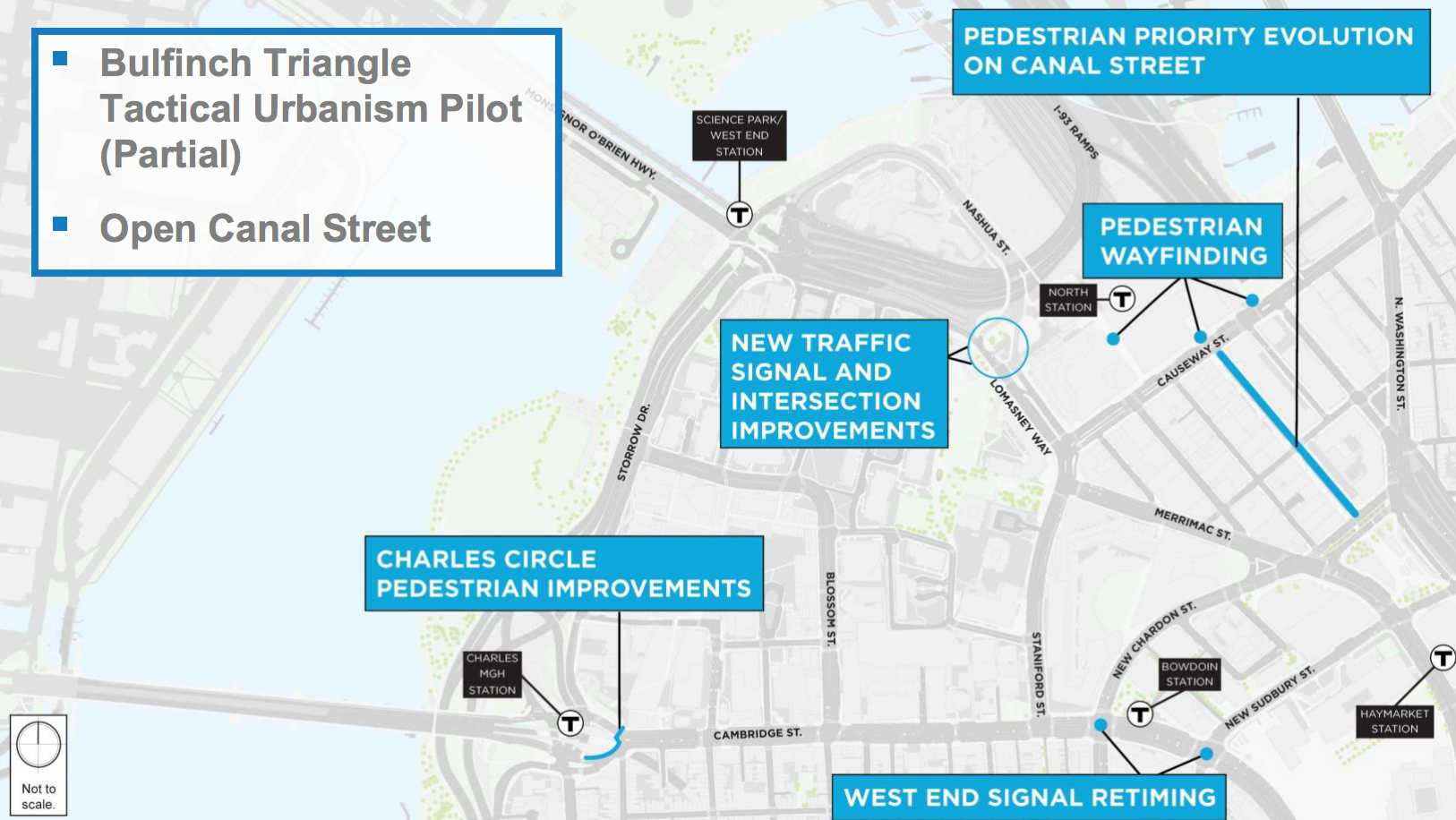
In addition to signaling, adjusting curbside parking and adding wayfinding through interactive transit screens, closing Canal Street to create a “pedestrian priority” is also a possibility:
Transit & Shared Mobility: Looking to consolidate all shuttles into one central area while planning for the potential of a bus lane on North Washington Street and a ferry terminal at Lovejoy Wharf.
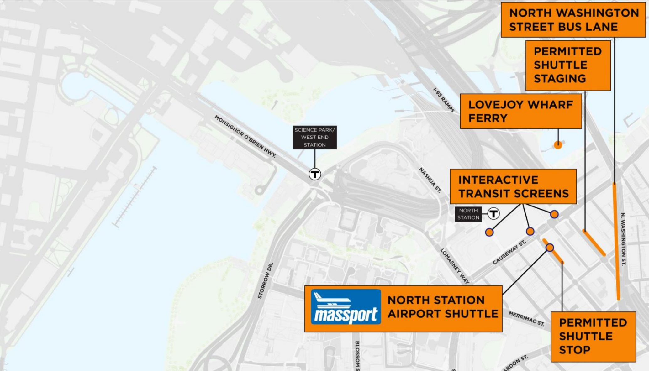
As for the Bulfinch Triangle:
Overall, the plan hopes to it easier for vehicles to commute through the Bulfinch Triangle. Officials are considering directional changes for several one-way streets:


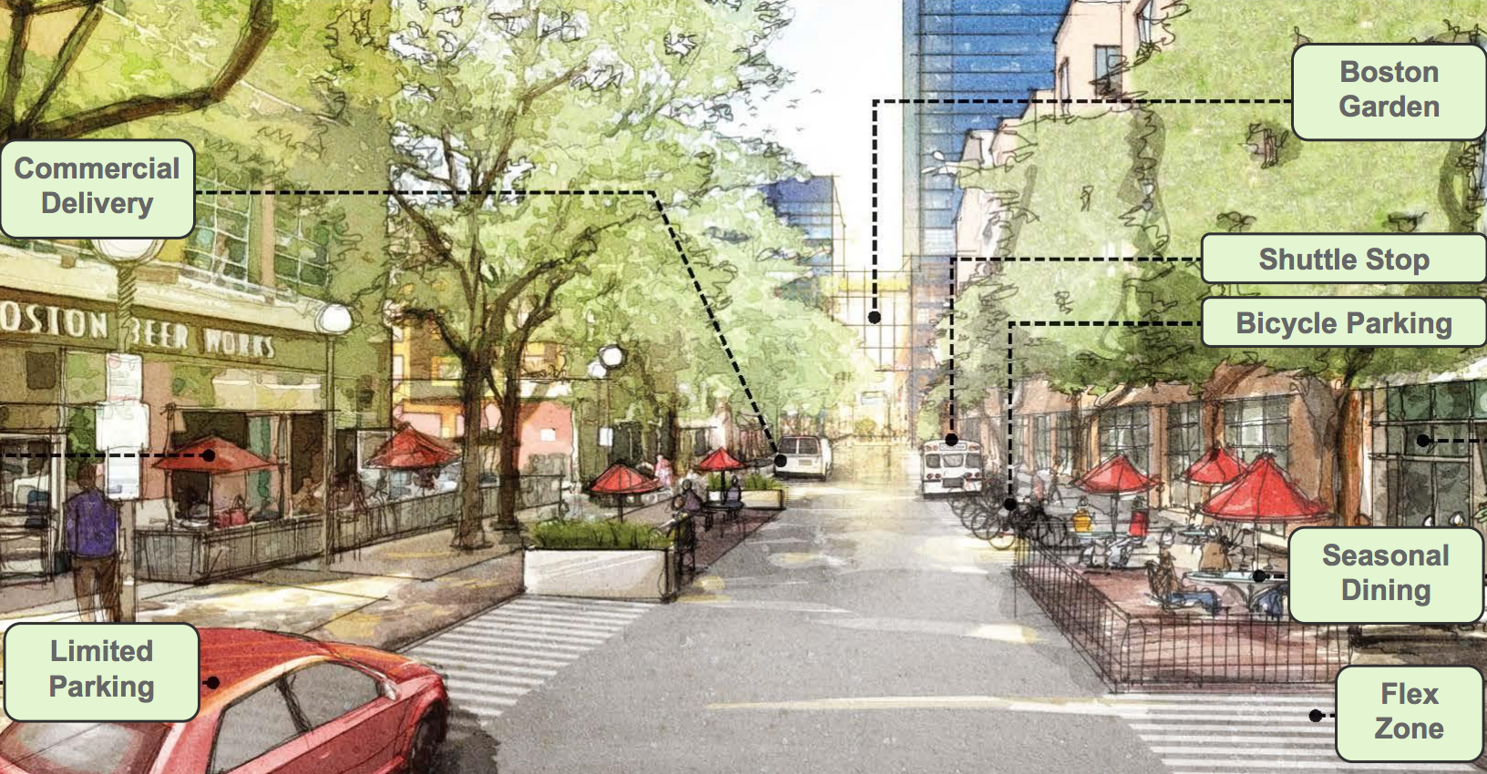
With foot traffic expected to increase by 50%, making Canal Street more pedestrian friendly is featured throughout the plan, including a possible shut down of vehicle traffic.
Could this be the future of Canal Street?
To support the city’s effort, a total of $400,000 was contributed to this plan by eight private partners: Massachusetts General Hospital, Delaware North (owners of the TD Garden), Equity Residential, AvalonBay Communities, Related Beal, Boston Properties, HYM Investment Group, and Trinity Financial.
For your input on the project and proposal, submit comments here. Looking for more information? View the presentation.
[hr]


Raised pedestrian walk across Causway St. allowing fewer stop lights would help a lot.
Do I understand correctly that this plan identifies Uber and Zipcar as the first automotive device floating freely above the streets, thus alleviating congestion?