In advance of a public meeting next week, the Boston Redevelopment Authority has released a draft planning document for the Downtown Waterfront. If you’ve been following our coverage and meeting videos for the Downtown Waterfront Municipal Harbor Plan then you have already seen some of these concepts. However, this is the first time a draft of the complete document has been released to the public. Here are some excerpts from the plan:
At the Northern Avenue Bridge:
Priorities for this area include improving Northern Avenue between the Coast Guard Building and Hook, as a multimodal street with appropriate greenscape; creating a fully accessible HARBORWALK on both sides of the Northern Avenue Bridge (whether this means going below the renovated bridge or on it); and creating an accessible HARBORWALK path across the Moakley Bridge (again, this may mean going below the bridge).
Comparing Rowes Wharf and Harbor Towers:
Rowes Wharf is a very successful example of a waterfront development that was guided by Chapter 91 principles. Rowes Wharf is thoroughly integrated into its context, with an active waterfront edge, a wide range of water transit options, public programs, and a welcoming gateway from the Greenway.
The Harbor Towers, on the other hand, remain aloof from its surroundings. … Smart design, landscape improvements, and clear wayfinding for public paths can ameliorate this situation and help make the Harbor Towers the center of the emerging downtown waterfront residential community.
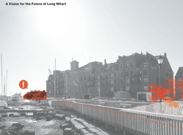
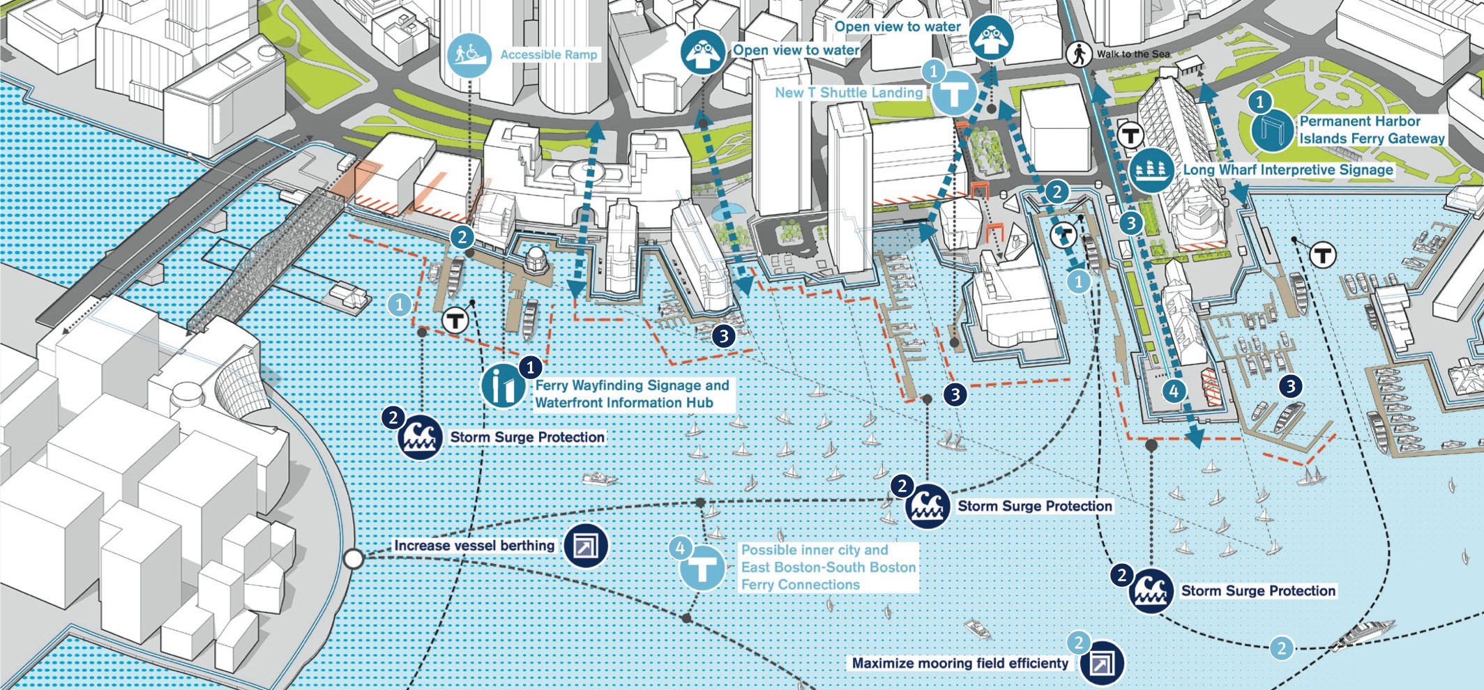
At Long Wharf and Central Wharf (Aquarium):
This is the most activated waterfront in Boston. … The primary objective is to create an exemplary twenty-first-century waterfront, so generations to come can experience the water’s edge. … Both incremental physical improvements as well as management strategies can help organize and clarify the public realm and movement through this area.
For the Boston Harbor watersheet itself:
Climate change, sea level rise, and storm surges threaten the waterfront, but they also present the opportunity to rethink the watersheet and water’s edge as a twenty-first century resilient landscape. This may include physical storm barriers or soft infrastructure and landscape that withstand regular flooding and inundation.
Key development sites at the Harbor Garage and Hook Lobster parcels are identified as opportunities for additional public realm activation in the report.
Download the 50-page illustrated draft plan (pdf file) at the following link:
DRAFT – Downtown Waterfront Public Realm and Watersheet Activation Plan (4-9-14) pdf
The draft plan will be discussed at the next Downtown Waterfront Municipal Harbor Planning Advisory Committee on April 23rd at Atlantic Wharf, 290 Congress Street.
Comments can be submitted by May 2nd to:
Chris H. Busch
Senior Waterfront Planner
Boston Redevelopment Authority
One City Hall Square
Boston, MA 02201
617-918-4451
chris.busch@boston.gov


