Community Police & Fire Real Estate

FEMA / Americorps Introduce New Flood Maps Effective March 2016

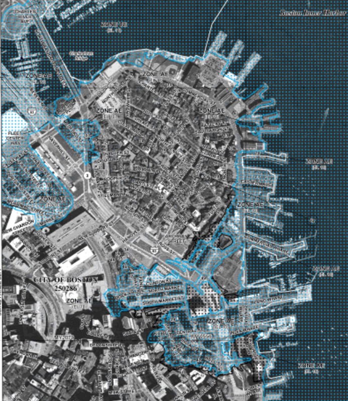
On March 16, 2016, new FEMA flood maps go into effect in Boston. Representatives from FEMA and Americorps spoke about the implications at the February meeting of the North End / Waterfront Residents’ Association (NEWRA). The National Flood Insurance Program (NFIP) is a federal program that mandates flood insurance for any structure located in a high-risk area (the Read More…

Event Notices

Monday! December 14th NEWNC Agenda: 92 Salem St, Flood Maps, Boston 2030, Beautification

North End/Waterfront Neighborhood Council Website: www.NEWNCBoston.org Email: info@newncboston.org NEWNC AGENDA Monday, December 14, 2015, 7:00PM Nazzaro Center, 30 North Bennet Street 1.     Welcome:  NEWNC President 2.     Call to order & Roll Call:  NEWNC President 3.     Meeting Protocol:  NEWNC Vice President 4.     President’s Report:  NEWNC President 5.     Committee Reports: Read More…

Community Government Health & Environment Photos & Videos Police & Fire Real Estate

New Year Nor’Easter Brings Rising Tides and Flooding to North End Waterfront [Photos]

The nor’easter snowstorm started off the year with not only 14 inches of snow to the North End waterfront, but a record high tide from Boston Harbor. The rising sea level resulted in significant flooding shortly after noon on Friday, January 3rd. Harbor levels appeared higher than those seen during Hurricane Sandy in 2012 despite Read More…

Community Government Health & Environment Police & Fire Real Estate

Many North End Waterfront Property Owners Will Need Flood Insurance Under New FEMA Maps

New preliminary flood zone maps have been published by FEMA and the flood line for the Boston’s North End / Waterfront goes much further inland than the previous risk assessment. If the maps released on November 15, 2013 go into effect as planned, property owners within the 1% chance flood line (i.e., the 100-year flood) Read More…