Video: Lauren Zingarelli from the Boston Environment Department discussed the new FEMA Flood Maps for the North End at the December 14, 2015 NEWNC meeting.
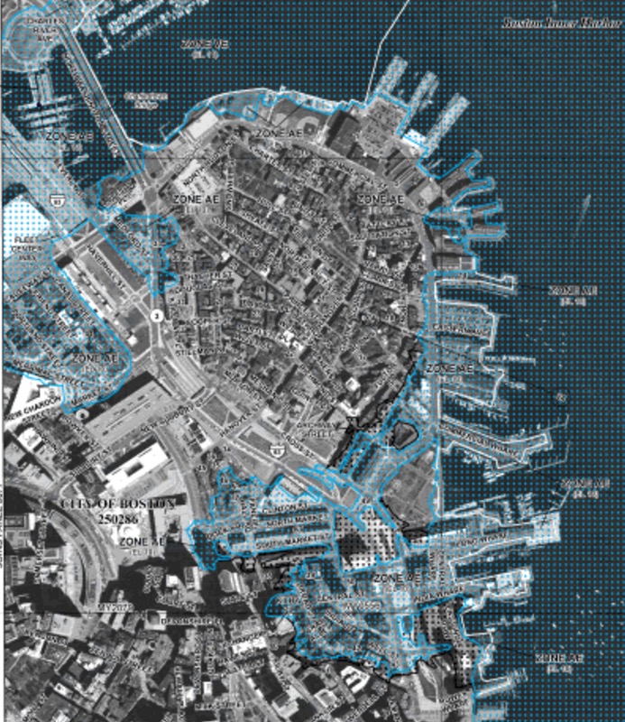
Changes to the Flood Insurance Rate Maps for the City of Boston go into effect on March 16, 2016. Federal Emergency Management Agency (FEMA) has been revising flood maps to reflect current flood risks in coastal areas nation-wide over the last few years. The specific North End / Waterfront map is shown below and can be viewed online here.
The National Flood Insurance Program (NFIP) is a federal program that mandates flood insurance for any structure located in a high-risk area (the 100-year floodplain) that has a federally backed mortgage on the property.
The revised maps provide more information about flood risks for new and existing development. The updated FIRMs for Boston are available at the FEMA Map Service Center and will go into effect on March 16, 2016.
FEMA and the City of Boston will host a community open house on January 12, 2016 to assist people with navigating the FEMA flood maps and to answer any questions. Please find all details and RSVP here.


That was a painful presentation to watch