5am weather briefing from the National Weather Service – Boston:
As to snow …
Winter Weather Advisories continue through as late as 3 pm. This may be extended to as late as 1 am Sunday depending on how the threat of freezing rain / drizzle evolves during the afternoon into evening period (more on that below).
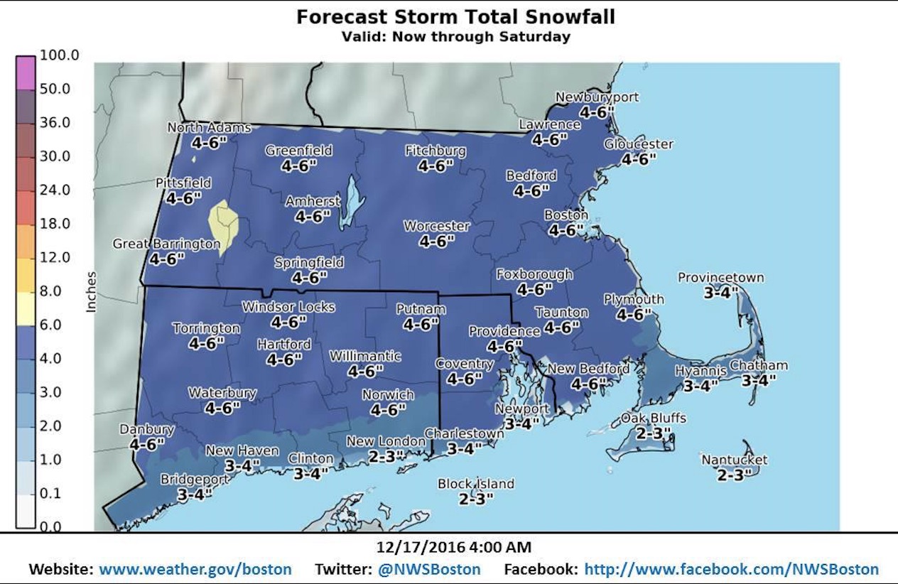
A general 4 to 6 inch snowfall is forecast. Visibility will be as low as half a mile at times as moderate to heavy snow is forecast. Travel will be hazardous.
As to ice …
As snow transitions to rain south to north there is forecast to be a brief period in-between of sleet and / or freezing rain. But it is also at this time that precipitation will be coming to and end, lingering perhaps as drizzle (thus the uncertainty as to whether to extend the Winter Weather Advisory).
Trace amounts to a glaze are forecast with respect to ice accretion. In addition there is the potential for a flash freeze, this as we go late into the day into the evening when winds turn back out of the north and reintroduce sub-freezing temperatures, in particular for regions across Northern and Eastern MA. Water along area roadways, untreated especially, would be expected to freeze as black ice with the reintroduction of colder air.
As for rain …
Precipitation is forecast to be all rain across all of Southern New England around 1 am Sunday at the latest. Areas across Northern MA will hold out the longest with the threat of freezing drizzle.

