An update from the North End/Waterfront HazMat Task Force:
Neighbors,
I hope you are enjoying the summer. It’s been a while, so this note is to let you know that the Hazardous Material Truck issue is still alive and that your neighbor activists are still active, both out in front and behind the scenes. By way of update, during the summer we have been conferring every other week, meeting with Commissioner Tinlin’s office, Rep. Aaron Michlewitz, Anne Lynch (Trucking Association) and by phone with Battelle, the firm commissioned to present a survey and safety report to the City & State. This report is key and it is expected to be completed within the next few weeks.
After the report is filed, it is up to the State Department of Transportation (MassDOT) to conduct a public process and “make a decision” on the “routing” of hazardous cargo vehicles. In addition to the route, there are also the questions a “ban” for certain hours and permitted city cut-throughs.
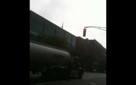
Since the compromise decision allowing HazMat trucks to travel both Cross and Commercial Streets, the trucking companies been using mostly Cross Street, as requested by city officials, with a ban during rush hour traffic periods. While this has been a cooperative move, the HazMat Task Force’s long-term goal to ban HazMat trucks from cutting through the North End/Waterfront altogether.
The Task Force is made up of members representing all the major neighborhood groups, NEWNC, NEWRA, Chamber of Commerce, Columbus Park volunteers and waterfront buildings including Harbor Towers.
As Battelle is located in Ohio, we are making sure that they have all the information vital to protecting our neighborhood. Many of you have contributed to our research and we have recently submitted our latest data sheet highlighting the dangers of hazardous material cargo trucks in the neighborhood.
Thank you for your support. Please continue to make your concerns known to your elected and all other public officials.
All the best,
Mario Alfano (for the HazMat Task Force)
The text from the data sheet is pasted below:
North End/Waterfront Population Density
Updated edition: 8.26.10
The U.S. Department of Transportation lists population density and Impact Zone high among factors for determining the routes of Non-Radioactive Hazardous Material (NHRM or HazMat). With that priority in mind, we have compiled the following statistics, with citations for each.
Census Data: Year 2000 census reported 10,026 people residing in the North End on one-quarter square mile (0.2696 sq mi, to be exact). This equates to a population density of 37,188/sq. mile, more than three times the density of the overall City of Boston (12,813/sq. mile). By comparison, Somerville has the largest density of all cities in Massachusetts at 18,870/sq. mile, which is less than half that of the North End/Waterfront neighborhood. Year 2010 Census data will likely show a significant increase in population due to housing and commercial buildings developed in the past decade.
Every North End/Waterfront resident or visitor lives or travels within 1/2 mile of any current trucking route through the neighborhood. Over 2/3 are within 1/8 mile of any route. Population in the neighborhood increases by multiples each day and night from visitors, as you will see in more detail below. Please note that these statistics are provided in ascending order of impact.
Day care center: 60 children a day, aged infant to 5, crossing the HazMat route frequently.
Segway operation: 30-75 a day weekdays. 150 rentals a day weekends.
Bike shop: 300 rentals a week.
Parks and recreation facilities:
Mirabella Pool: 1,500 users who hold a card. 100s more use on day passes.
Puopolo Park: 9,550 people
Langone Park+Bocce court: 19,105 people (av. 52)
More people use Langone Park and bocce courts than the entire population of Charlestown
Funeral home: 350 events a year.
Schools and buses: One example: 15 Elliot school buses in morning; 8 in afternoon.
Tour bus and trolley tours: Trips by tour trolleys/buses is about 85 per day. Consider 20 per bus (1,700 people per day), over 600,000 per year. They have a capacity for well over 100 trips/day. All five major trolley tour companies in Boston use this route. The on/off companies have stops in front of Lewis Wharf and Steriti Skating Rink. Special tours (Ghosts/graveyards), charter hires and out-of-town tourist bus operations not yet included here.
Hotels and guest houses:
Mariners House: Home to approximately 5,000 visiting merchant sailors annually.
Fairmont Battery Wharf Hotel: Over 54,000 guests this year. Meals served to over 85000. Another 20,000 people come through the doors either visiting or for meetings.
Marriott Long Wharf Hotel: 300,000 hotel guests occupying guestrooms yearly, plus 200,000 meeting attendees.
Tourists: Paul Revere’s homestead: Over 250,000 visitors.
Old North Church: Over 500,000, and inching back to a max year in 2000 of 650,000.
Freedom Trail: 3,000,000 visitors. This HazMat route impact 6 of the significant
sites: Faneuil Hall, Paul Revere House, Old North Church, Copp’s Hill Burying
Ground, Bunker Hill Monument, USS Constitution
Affecting all populations:
Sewers. The North End/Waterfront sewers are combined: roadway drains connect to sanitary sewers. This provides a direct path for spills, waste and potentially fire to directly enter residences and businesses.
Our original research considers an Impact Zone (DOT) of 1/8 mile along Commercial and Atlantic streets. Since this research began, we have learned that the actual Impact Zone is 1/4 mile, so these numbers are conservative. Thanks to nearly a dozen residents who helped research this data.
As we look more broadly, no nearby pass-through route satisfies a population impact factor. The Boston Globe reported this summer that 16 million people visit Faneuil Hall every year, and 1.3 million make it over to the Aquarium. That is 16 million people on one site abutting an existing HazMat route, with 1.3 million on foot walking across that route.
Others can make a case for dangers of such travel anywhere in high-traffic, high-tourism and residential areas of downtown Boston. We believe that these facts demonstrate how the dangers of this North End route not only equal, but surpass any other travel route. We serve an overall population in the North End that, in fact, with each new year, nearly triples the entire population of Boston.
Research courtesy of North End/Waterfront HazMat Task Force
Sources:
The resident members of the North End/Waterfront HazMat Task Force researched the above statistics. All are volunteers. Their contacts are listed below. All research was compiled between 5.15.10 and 8.26.10. Additional information is available on request.
Census Data: 2000 published data, along with 2005 and 2010 projections
Day care center usage: KinderCare, Maureen Bird, Director
Segway operation: Boston Gliders, Manager: 617-888-0474
Bike shop: Urban AdvenTours: Boston Bicycle Tours & Rentals Manager: 617-670-0637
Parks and recreation facilities:
Carol Flaherty, DCR/Urban Parks & Recreation Permit Bureau
Brian McLaughlin, Executive Secretary, Boston Parks and Recreation
Funeral home: National corp: Dignity Memorial. General manager Courtney 617-536-4110
Schools and buses: Researcher observation
Tour bus and trolley tours: Published schedules of the five primary tour companies
Hotels and guest houses:
Victor Aragona, Manager, Marriott Long Wharf Hotel
Matthew Sterne, Manager, Fairmont Battery Wharf Hotel
The Mariners House Executive Director Michael Cicalese
Tourists:
Freedom Trail website: www.thefreedomtrail.org/about/case-statement.pdf
Old North Church: Rev. Steve Ayers, Vicar.
The Boston Globe. June 3, 2010:
www.boston.com/realestate/news/articles/2010/06/03/chiofaros_ambitions_grow/