
On April 22, 2010, a 6.5’ x 9’ Freedom Trail Map was unveiled on Cross Street in the North End at the location of the former Martignetti’s Liquors. The map is mounted on the brick wall between the Citizens Bank ATM and Nick’s Famous Deli. DePasquale’s Pasta Shop and Caffe Grafitti are also located in the newly renovated building.
Joe Milano, President of the Union Oyster House and a Hanover St. jewelry store, said, “The map looks great. It acknowledges the history of the Union Oyster House.” Other reactions were similarly positive. “I love it,” said Nick Varano who operates his deli in the adjacent storefront. State Representative Aaron Michlewitz commented that “the building facade is finally coming together.” The BRA’s Peter Gori noted that the sign had to be low enough to meet ADA requirements so there is the possibility of a “Welcome to the North End” sign above it to fill out the space. Many attendees were hopeful that upcoming changes with less traffic and parking in the sidewalk plaza would make it more inviting. Outdoor tables are expected to be located at various spots on the sidewalk.
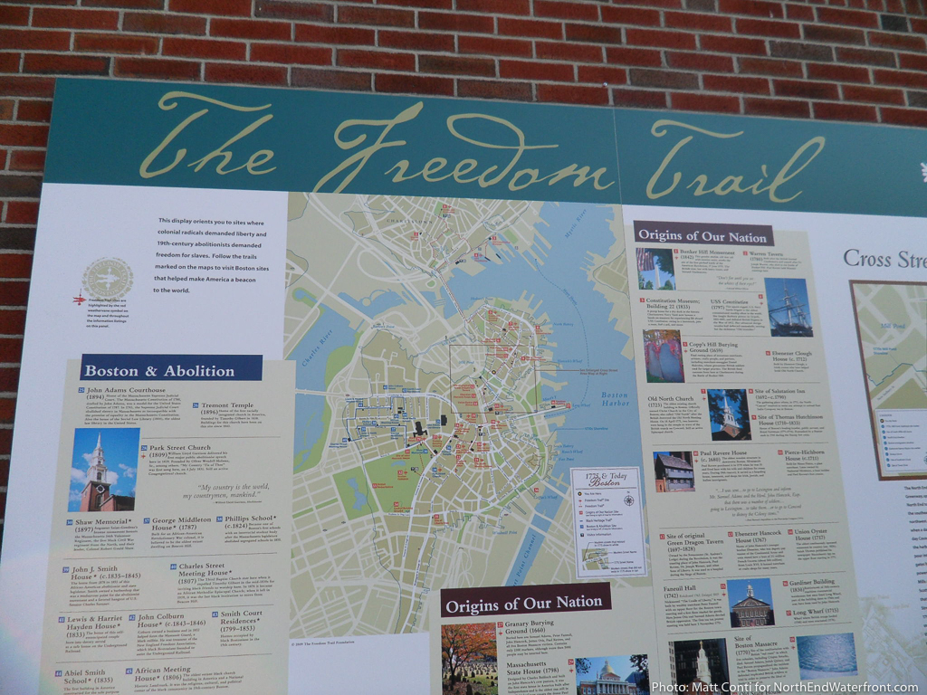
The map was a joint effort by building owner Citizens Bank, the Freedom Trail Commission and the Boston Redevelopment Authority. In addition to 18th century tour guides, participating in the unveiling was Robert Matthews, Vice Chairman, Commercial Banking at Citizens Financial Group; Mimi LaCamera, President of the Freedom Trail Foundation, Boston Mayor Thomas M. Menino; and State Representative Aaron Michlewitz. A reception followed at the neighboring Nick’s Famous Deli.
The Freedom Trail in Boston is the largest attraction in New England with three-million visitors annually. Residents of Massachusetts and tourists from around the globe walk the 2.5-mile route through the heart of Boston to see the 16 nationally significant historic sites that tell the story of the American Revolution.


