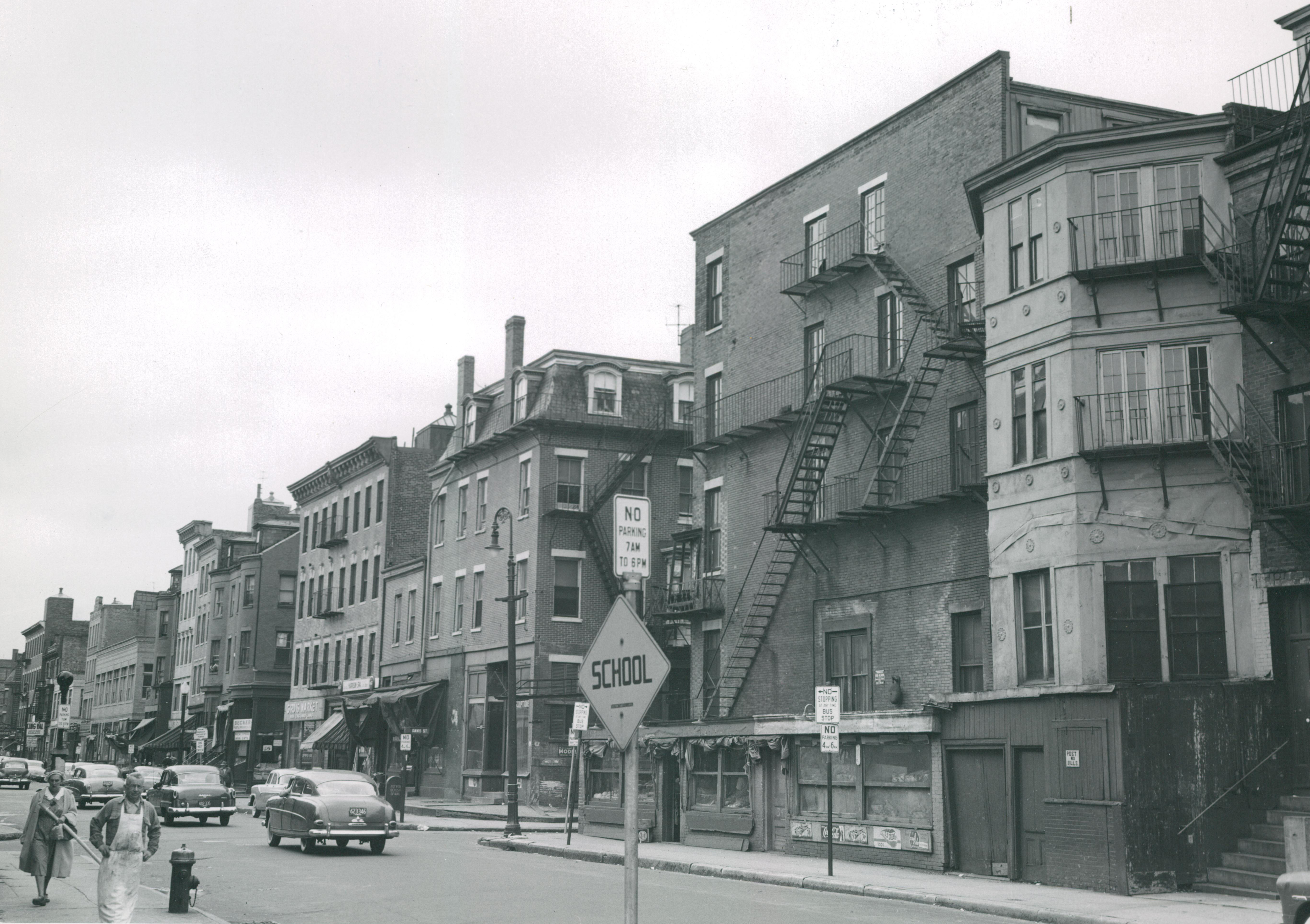
 Prior to the demolition of Boston’s old West End, another vibrant, multi-ethnic neighborhood of tenement houses and mom-and-pop shops fell victim to so-called ‘urban renewal.’
From February 21 through Fall 2017, The West End Museum hosts The New York Streets: Boston’s First Urban Renewal Project, a new exhibit that tells the story of this lost ‘sister’ community. At the opening reception—February 21, from 6:30 to 8:00 p.m.—attendees can tour the exhibit and enjoy light refreshments. The exhibit and reception are free and open to the public.


“The New York Streets project preceded the more infamous redevelopment of the West End,” says Museum Curator Duane Lucia. “But, in much the same way, federal funding was used to demolish an entire neighborhood and displace its residents with total disregard to the hardship it would cause them.”
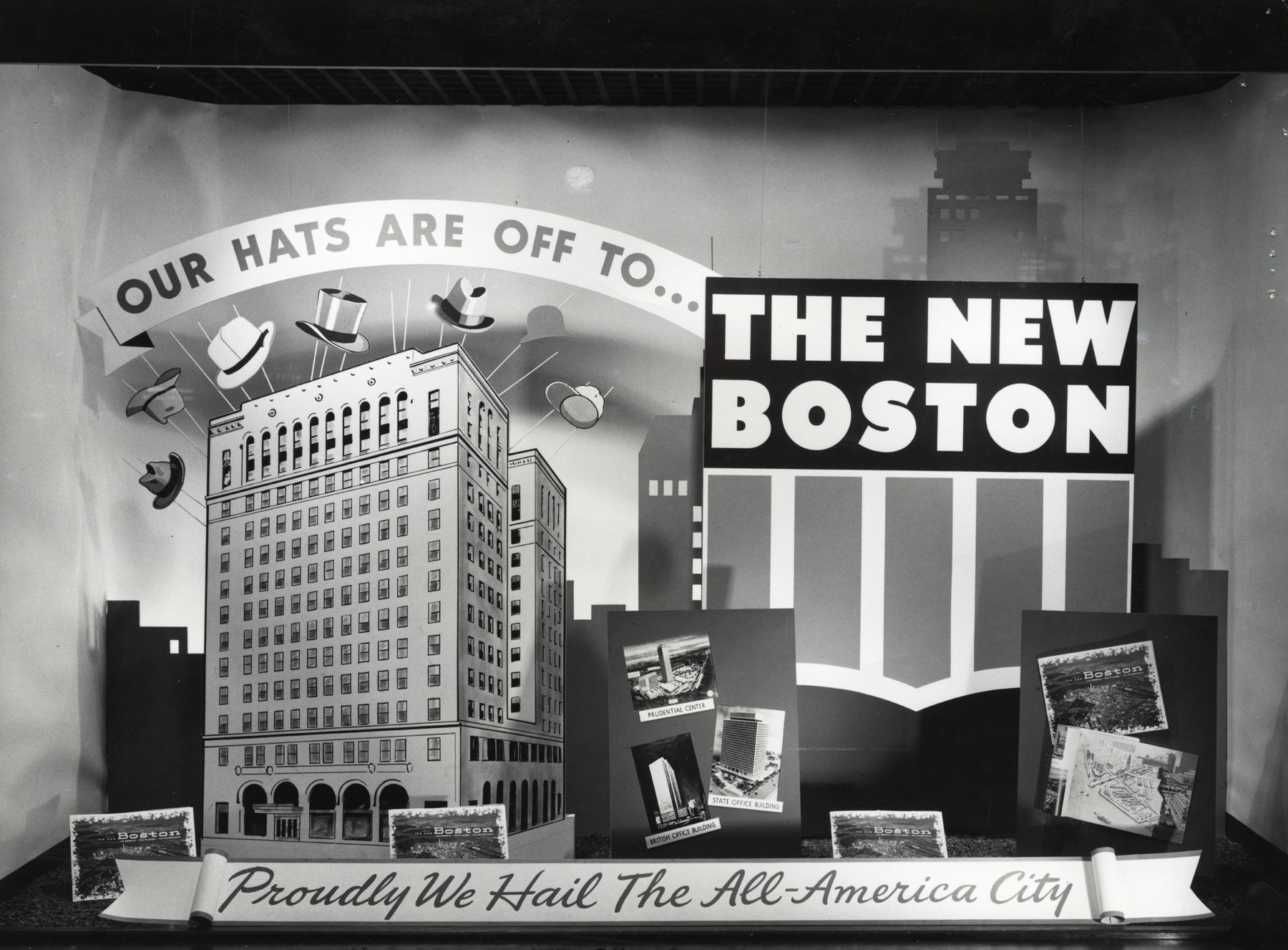
The New York Streets encompassed 24 acres of land comprising 12+ city blocks in the northeast corner of the South End. The area got its moniker when roads there were named after cities along the Erie Canal to commemorate the connection of railroad between Boston and Albany in 1842. They included Troy, Rochester, Genesee, Oswego, Oneida, Seneca and Albany itself, the sole remnant street name from that era in today’s South End. That corner of the Mass. Pike and Interstate 93—now home to the Ink Block complex and other high-rise apartments and a hotel with ground-level shops and restaurants—is otherwise unrecognizable.


First to fall under the axe of redevelopment in the City, the largely immigrant working class and working poor neighborhood had no means to fight City Hall when, in 1952, planning began to level the area and make way for the new Boston Herald Traveler newspaper plant and other industrial facilities. The City took control in 1955 and, by 1957, 321 buildings had been demolished and 1,000 residents displaced from their homes and community.
(Courtesy of the Boston City Archives)
Through graphic panels and a collection of original photographs, The New York Streets: Boston’s First Urban Renewal Project, recounts the neighborhood’s history; ethnic, religious and social life; urban renewal and impact; and modern-day status. It also highlights some of the areas most famous residents, including Louis B. Mayer, Jack Levine, Mary Antin and Mel King.
The exhibit is free and open to the public at The West End Museum, 150 Staniford Street, Boston.


This looks terrific. That part of the South End was home to a close knit community of Lebanese and Syrian Christians, Germans and Jews. The original Red Fez restaurant was started by members of that community.
The Housing Act of 1949 gave cities money for “slum removal” but it was left up to each city to determine which neighborhood was a slum. Boston was desperate to get a piece of that money so neighborhoods without a lot of political clout suddenly became slums.
To me, the pictures show a wonderful urban ethnic neighborhood. I’ll bet the residents didn’t think they lived in a slum.
You would think we would learn from history.
The developers and city should value the wonders of Boston instead of altering them. Each time the powers that be ignore the past, we lose another bit of the unique and special air of our city.